Digital map data
Some of the Kuopio map datasets are open data and are available free of charge through the WMS service and the Avoindata.fi service.
Materials in file formats used by planners can be ordered for a fee. Modified map material that meets your needs can be ordered by e-mail (paikkatietopalvelut@kuopio.fi) or by e-form using the links in the e-form list below.
As a rule, the disclosure of open and paid materials takes place in the ETRS-GK27 coordinate system and only in the N2000 elevation system (Kuopio coordinate system)
Kuopio Map Service offers an opportunity to view and print digital map materials and download related documents for minor private use. The descriptions of the data are read from the Geospatial Data Directory of the National Land Survey of Finland.
The user of spatial data sets distributed on the websites of the City of Kuopio and the services connected to them accepts the terms and conditions related to the data.
-
Modified map and spatial data sets that meet the needs for use can be ordered as paper printouts. Digital data can also be ordered in the most common file formats, such as
a base map in dwg format.Map extracts can be ordered on the form as attachments to various permit applications in PDF and paper printouts.
-
-
-
-
-
- View in the map serviceThis link will open to a new tab
- Tasavallankatu (pdf, in Finnish)This link will open to a new tab
Inquire by email: paikkatietopalvelut@kuopio.fi
-
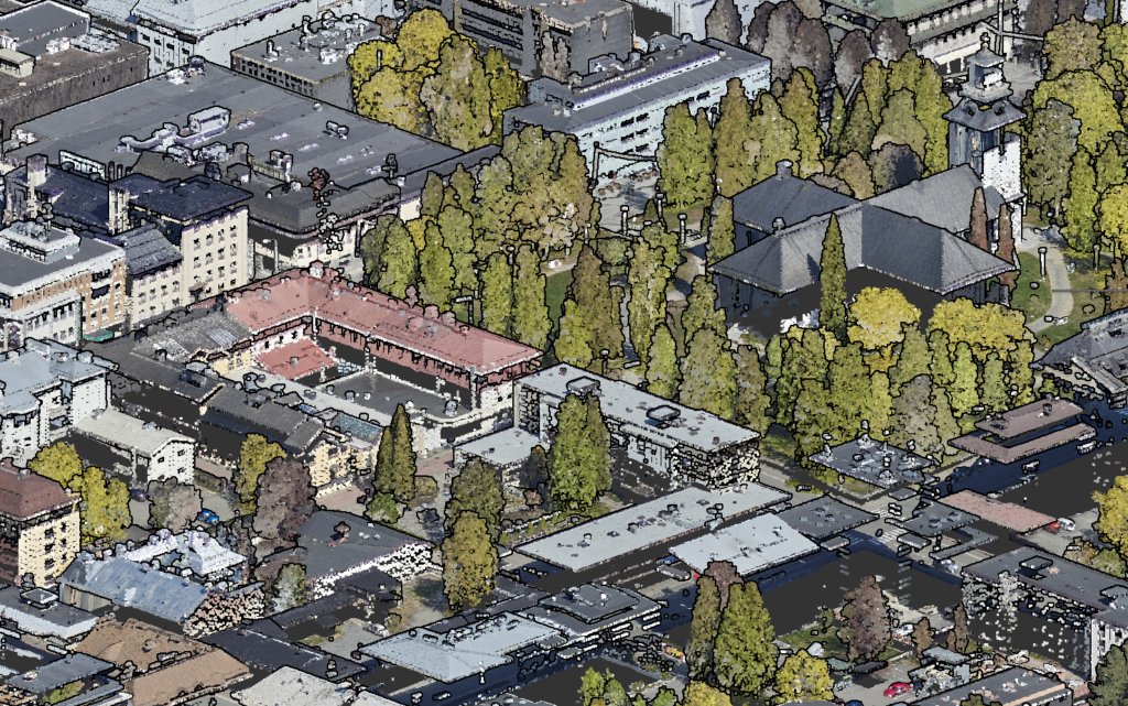
Laser scanning data is a three-dimensional point-like dataset that describes the ground surface and the objects on it. Each point has x-, y- and z-coordinate data, and the data is divided into different categories, such as ground surface, vegetation, roof surfaces of buildings, and bridges. Depending on the dataset, laser scanning has an accuracy of approximately +-1–15 cm on a flat surface and a point density of approximately 15–60 points per square metre. The data can be used to create accurate ground surface models for planning. Point categories include ground surface, low vegetation, medium vegetation, high vegetation, buildings and water. Aerial laser scanning has been carried out in the area of City of Kuopio in 2007, 2009, 2012, 2017 and 2022.
The image below shows the coloured laser scanning data for 2022